Storm Eunice: Flood warnings issued for eight areas of Flintshire

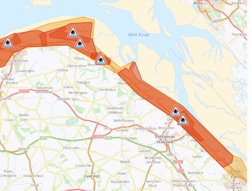
Stormy weather has prompted flood warnings to be issued in seven areas of Flintshire that run alongside the River Dee.
An amber weather warning is in place across Wales and large parts of England tomorrow, with gusts of more than 70mph expected locally.
The Met Office has said this morning the amber alert will be active from 5am through 9pm on Friday.
According to Natural Resources Wales, flood warnings are in place for high tide on Friday morning and is “based on current forecast in response to Storm Eunice.”
“The high tide is at 12:15 PM on Friday 18 February.”

The eight areas along the River Dee where the flood alerts are in place:
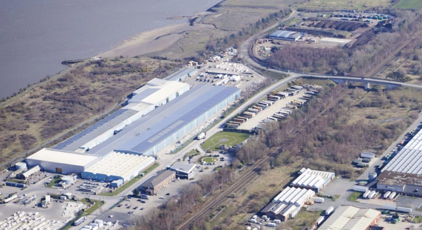
Parts of the town including the Castle Park Industrial Estate and Evans Street to Marsh Lane
The area alongside the Hawarden Embankment of the River Dee including Queensferry, Sandycroft, Saltney and Connah’s Quay
The area alongside the Hawarden Embankment of the River Dee including Queensferry, Sandycroft, Saltney and Connah’s Quay
Dee Bank, Boot, Whelston, Wal-wen and Greenfield business park
The communities of Greenfield and Bagillt, from the outskirts of Flint up to Mostyn Docks
The area inland of the railway line from Tan Lan to Shore Road and Presthaven Sands holiday park
The community of Talacre from the gas terminal to Tyn y Morfa
Flintshire Bridge will close at 6am on Friday the council has said it won’t reopen until at least 6pm.
⚠️ There are now multiple flood warnings and alerts in place right across the Wales coastline
Communities in at risk areas should take precautions and find out how to prepare for flooding: https://t.co/rgaNf8grNC
Warnings are updated every 15 minutes https://t.co/70k4H9hhns pic.twitter.com/V5lp6r50vs
— Cyfoeth Naturiol Cymru | Natural Resources Wales (@NatResWales) February 17, 2022
Welsh Government ministers are meeting this afternoon to discuss preparations for Storm Eunice.
A rare red warning is in place across parts of South Wales where the most significant gusts in exposed areas could be in excess of 90mph
Red warnings are rarely issued by the Met Office, with the last one coinciding with Storm Arwen in November 2021.
Prior to that a red warning for wind hadn’t been issued since March 2018.
First Minister Mark Drakeford has issued a warning to members of the public to “make preparations today so you can keep yourself and loved ones safe.”
He said: “We are working very closely with national agencies, local authorities and the emergency services to prepare for the incoming storm Eunice.
“A red warning has been issued for much of south Wales from 07.00 tomorrow, which means there is a danger to life.
“Amber warnings will be in place from early Friday morning for the rest of the country.
“We are expecting significant disruption to travel – all trains in Wales will be cancelled on Friday – so please think carefully and only travel tomorrow if absolutely necessary.
“I attended a COBR meeting earlier today and the Welsh Government Cabinet is meeting this afternoon to discuss preparations for the storm.
“We will constantly monitor the situation and will keep the people of Wales updated.
“Please make preparations today so you can keep yourself and loved ones safe.”
Met Office Chief Meteorologist Frank Saunders said: “After the impacts from Storm Dudley for many on Wednesday, Storm Eunice will bring damaging gusts in what could be one of the most impactful storms to affect southern and central parts of the UK for a few years.
“The red warning area indicates a significant danger to life as extremely strong winds provide the potential for damage to structures and flying debris.
“Although the most exposed coastal areas in the south and west could see gusts in excess of 90mph, winds will remain notably strong further inland, with gusts of between 70-80mph for most within the amber warning area.”
Katharine Smith, Environment Agency Flood Duty Manager, said: “Strong winds could bring coastal flooding to parts of the west, southwest and south coast of England, as well as the tidal River Severn, in the early hours of Friday morning.
“This is due to Storm Eunice resulting in high waves and potential storm surge coinciding with the start of a period of spring tides.”
National Highways Head of Road Safety, Jeremy Phillips, said: “We’re encouraging drivers to check the latest weather and travel conditions before setting off on journeys and consider if their journey is necessary and can be delayed until conditions improve.
“If you do intend to travel, then plan your trip and take extra care, allowing more time for your journey.
“In high winds, there’s a particular risk to lorries, caravans and motorbikes so we’d advise drivers of these vehicles to slow down.
“Drivers of other vehicles should be aware of sudden gusts of wind which can affect handling and braking, and give high-sided vehicles, caravans, and motorbikes plenty of space. In the event of persistent high winds we may need to close bridges to traffic for a period, so please be alert for warnings of closures and follow signed diversion routes.”
[Photo: Industrials.co.uk]
Spotted something? Got a story? Send a Facebook Message | A direct message on Twitter | Email: [email protected]Latest News


