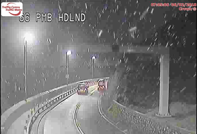
Light snow showers expected in Deeside this morning
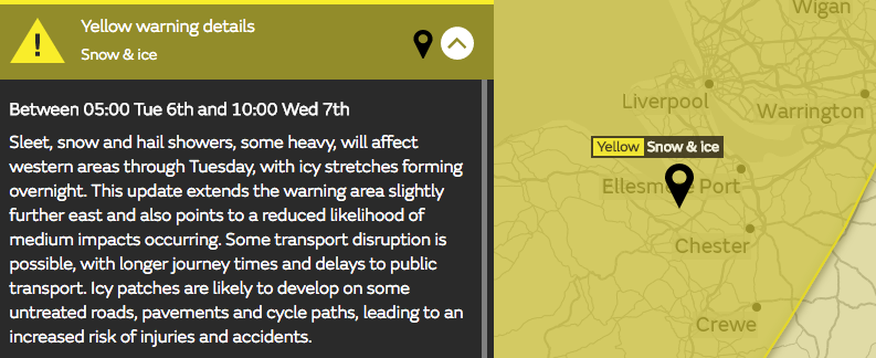
Sleet, snow and hail showers are expected to affect Flintshire today, Tuesday, February 6, the Met Office has issued a yellow weather alert for snow and ice across much of Wales and the north of England from 5am this morning through to 10am tomorrow.
Some snow has started to fall along the North Wales coast, it is expected to spread inland with forecasts suggesting Deeside could see some light flurries from around 8am onwards.
The Met Office warning states:
‘Sleet, snow and hail showers, some heavy, will affect western areas through Tuesday, with icy stretches forming overnight.
Some transport disruption is possible, with longer journey times and delays to public transport.
Icy patches are likely to develop on some untreated roads, pavements and cycle paths, leading to an increased risk of injuries and accidents.’
Chief Forecaster’s assessment;
“Further showers of snow, sleet and hail will affect western parts of the UK, these frequent in western Scotland and the north of Northern Ireland, where thunder is also possible. 1-3 cm of snow may accumulate at low levels inland, and perhaps 5-10 cm on hills above 200m.
Showers will gradually fade overnight Tuesday into Wednesday, with icy stretches developing as skies clear, particularly where earlier snow has partly melted. As is usually the case with showers, some places will miss them, while some coastal fringes may see rain or hail.”