Can you bank on the bank holiday weather? Here is what the Met Office has to say
The Hawarden airport weather station has noted the UK’s highest temperature today (9am) at 15ºC.
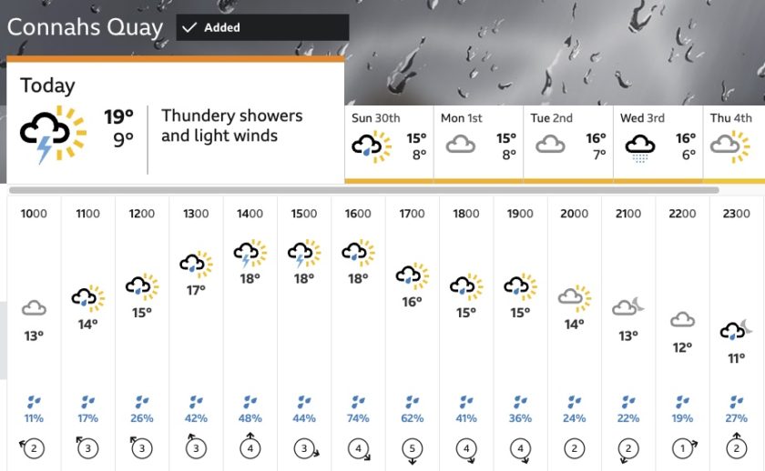
Although local temperatures are expected to climb to a possible 19ºC, thundery showers are also forecasted for the area.
Over the next three days, most regions will experience dry, bright, and relatively warm conditions.
However, some areas may also encounter slow-moving heavy showers, potentially causing localised impacts.
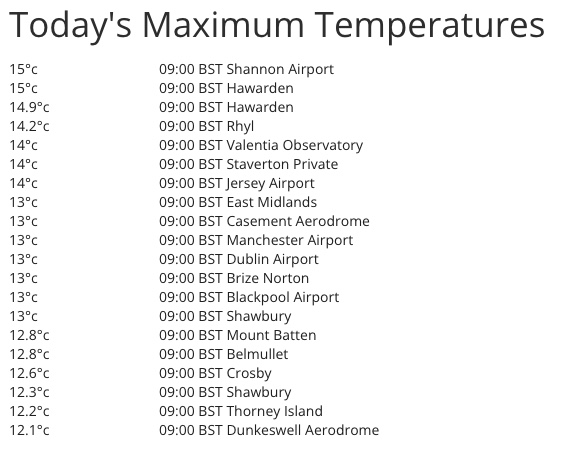
Temperatures as recorded at official weather stations at 9am on Saturday, 29 April.
Met Office Chief Meteorologist Matthew Lehnert said: “After many areas saw below average temperatures earlier in the week, temperatures are now rising across much of the UK as warmer air is drawn northeast from the North Atlantic.”
“This has brought a lot of moisture too which will help trigger showers as well as allow some low cloud to affect some coasts.”
“With light winds, showers that do develop will be slow-moving and lead to some heavy downpours, accompanied by hail and thunder at times.”
The focus for the showers, some of which are likely to be slow-moving, is expected to change over the course of the weekend
The focus for the showers, some of which are likely to be slow-moving, is expected to change over the course of the weekend.
On Saturday, the heaviest showers are likely to be focused across Northern Ireland, northeast Wales and central England.
On Sunday, showers are expected to affect a larger part of the UK, although central and southeast England are expected to remain mainly dry.
By Monday, drier conditions are expected to develop across the west, whilst showers become concentrated across eastern areas.
Although temperatures have risen in the south and west, Scotland will see another cool day on Saturday before recovering to nearer average on Sunday and Monday.
The first half of next week is likely to be dominated by high pressure with fewer showers around. However, during the second half of next week, low pressure looks likely to move closer to southwestern areas bringing the threat of more changeable conditions again.
With the air being drawn from southeast, this may allow temperatures to rise across southern areas into the low 20s Celsius but also introduce a chance of heavy showers which may be thundery.
If you are planning to be out and about next weekend for the Coronation, it is difficult to give lots of detail about the weather this far in advance however indications are we will see a mix of sunshine and showers. Keep an eye on the weather forecasts for updates.
Spotted something? Got a story? Email: [email protected]
Latest News
