Met Office issues another Yellow Warning for ice in Flintshire.
The Met Office has issued another yellow warning for ice Flintshire
The warning comes into force from 4pm today to Wednesday, December 13 at 11am
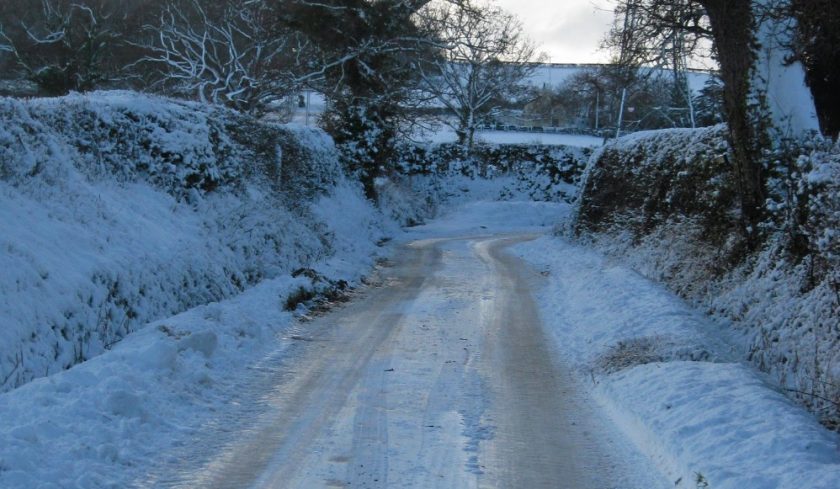
Ice is expected to form on some surfaces from late Tuesday afternoon and last overnight into Wednesday morning.
“There will probably be icy stretches on untreated roads, pavements and cycle paths with some injuries possible from slips and falls.” The Met Office says.
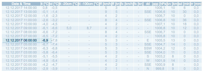
Overnight temperatures dropped to -6.9ºC, Hawarden was one of the coldest places in the UK, those sort of temperatures aren’t expected to be seen tonight.
All Coleg Cambria sites are due to reopen tomorrow having been closed on Monday and today due to icy conditions.
Weather Update
Update 12/12/17- 2pm
All Coleg Cambria sites will be fully open again from tomorrow, Wednesday 13th December 2017.— Coleg Cambria (@colegcambria) December 12, 2017
Latest weather forecast:
Today:
A sunny, but very cold start with severe frost, ice and some freezing fog patches which will be slow to clear. Some early showers in the west will fade, but it will turn cloudier with rain later. Maximum temperature 7 °C.
Tonight:
Turning windy with rain spreading eastwards through the first part of the night. Clearer skies will follow for a time, although further heavy, showery rain will arrive later. Minimum temperature 0 °C.
Wednesday:
Windy with spells of heavy and showery rain. Turning drier and brighter through the afternoon, but further rain, perhaps with some snow will arrive overnight. Maximum temperature 9 °C.
Outlook for Thursday to Saturday:
Windy on Thursday with sunny spells and scattered showers. Turning colder through Friday and Saturday with sunny spells and some showers, mainly in the west. Frosty overnight.
Chief Forecaster’s assessment:
‘A band of rain with some snow (this mostly on hills) will reach western Scotland and Wales on Tuesday afternoon and move quickly eastwards across all parts through the evening and overnight.
Whilst a brief spell of snow is likely, mostly on high ground in the north of the yellow area, the main hazard is likely to be icy surfaces where rain falls onto frozen ground.
This risk is greatest across parts of Scotland and northern England where the impacts could locally be greater than elsewhere.
Temperatures may then rise a little for a time overnight before falling again by Wednesday morning as cloud clears, so ice remains likely. In addition, some wintry showers may affect western Scotland on Wednesday morning.’