Coldest night of the year so far in Flintshire as temps plunge to low of -7ºC overnight
Flintshire has experienced the coldest night of the year for the second time this week, with temperatures falling to a bitterly cold -7º.
Initially, Monday was the coldest day of the year locally as Flintshire experienced sub-zero temperatures for most of the day.
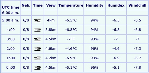
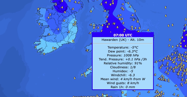
At 3am this morning a temperature of -7º was recorded at the Hawarden Airport weather station.
Temperatures during the course of today will remain very cold peaking a 1ºC.
Wintry conditions will continue until the weekend, before milder and wetter weather sweeps in to create a temporary reprieve.
Paul Gundersen is a Met Office Chief Forecaster. He said: “Over the last week, the UK has been held in a northerly airflow bringing cold, sometimes Arctic air, to the UK.
“We will still have this northerly influence to our weather patterns until the weekend, but then the cold conditions will lose exclusive dominance over the UK’s weather patterns and we will move into a regime where relatively mild and relatively cold conditions will vie for supremacy.”
“We can expect changeable conditions with colder and milder air not too far away from our shores, but it does seem that the Atlantic ‘has woken up’ compared with recent days and will be a stronger influence, countering any further bouts of extreme cold conditions, although spells of further wintry weather remain possible through the rest of December.”
Until this weekend’s transition we will continue to see wintry hazards especially in northern and eastern coastal areas. Overnight frosts will be severe in places and we will continue to see some freezing fog patches.”
The cold air from the Arctic is also bringing brighter conditions for many, with some dry and sunny weather, particularly away from coasts.
Steven Keates is a Met Office Deputy Chief Forecaster. He added: “The boundary between the two air masses will create a window for snowfall over the weekend.”
“This is likely to be transient in nature as the mild wet air from the west will ‘bump’ into the colder air, before displacing it further east. This potential spell of snow will lead to some temporary disruption before the snow quickly turns to rain.”
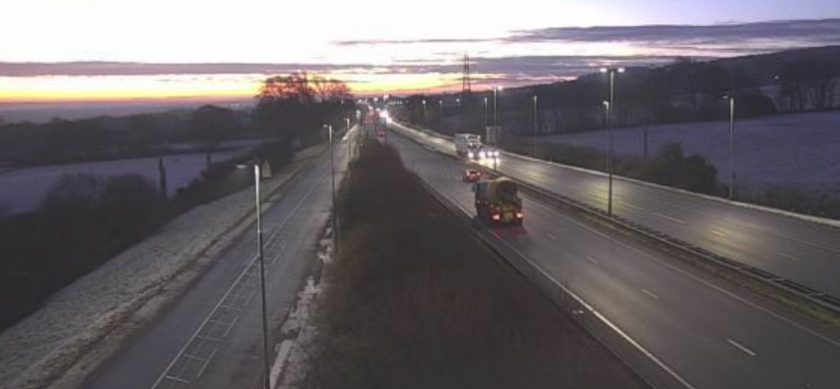
“While the freezing conditions remain, drivers especially are reminded that freezing fog, and other wintry hazards will continue to create difficult conditions in places this week.”
Check live fuel prices near you before you set off.
Spotted something? Got a story? Email news (@) deeside.com
NEW: Add Deeside.com as a preferred source on Google to see more of our trusted coverage when you search.
Latest News