Met Office issues another warning for ice and snow which could affect Flintshire
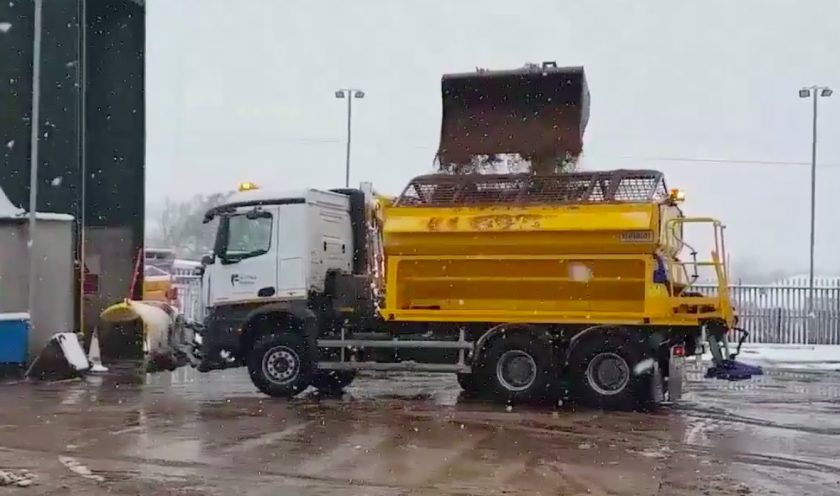
The Met Office has issued another yellow weather alert for ice and snow which comes into affect later this evening.
A yellow warning for wintry showers was in place overnight and up to 10am today but that passed with no real impact other than the odd hail shower.
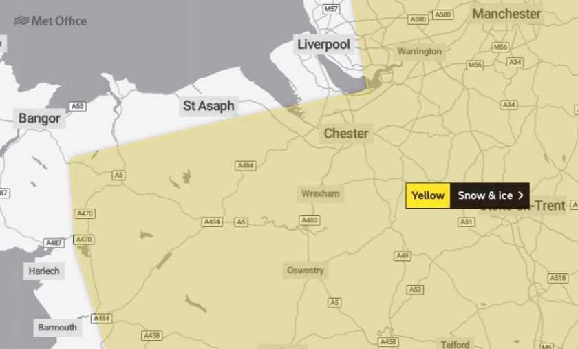
Todays yellow warning comes into play at 10pm tonight until 10am on Thursday morning and covers Flintshire as well as neighbouring counties in both Wales and England.
The warning states:
“Wintry showers are expected to continue through Wednesday night into Thursday morning, especially over Northern Ireland and western Scotland, before developing more widely across parts of northern England, the north Midlands and north Wales later in the night.
This will leave surfaces wet, leading to icy stretches developing on untreated surfaces.
Showers will fall as a mixture of hail, sleet and snow.
Some places are likely to see 1-3 cm of snow, mainly above 100 m, with 5-10 cm possible above 400 m.”
Paul Gundersen, Chief Meteorologist with the Met Office, said:
“The flow of cold air over the UK will lead to heavy, wintry showers and icy conditions overnight. From 10pm Wednesday until 10am on Thursday there is a Met Office Yellow warning for snow & ice for most of the UK north of a line from the central Wales to the Wash, except north-east England and eastern Scotland.
“A low-pressure system moving in to the South West from the Atlantic overnight will bring a further period of rain to southern England.
As this system encounters the cold air further north over the UK, there is a risk of snow along this boundary and we have issued a Yellow warning north of the M4 corridor from central Wales, parts of the Midlands and East Anglia. Snowfall up to 5cm is possible over higher ground in South Wales, with 1-3cm possible over the Cotswolds and the Chilterns.
It is possible that rain may briefly turn to sleet or snow over lower ground across the Midlands, East Anglia and areas north of London, although accumulations here are likely to be small.”
Rain, sleet and snow will quickly clear eastwards by late morning and any snow at lower levels will soon thaw.
Check live fuel prices near you before you set off.
Spotted something? Got a story? Email news (@) deeside.com
NEW: Add Deeside.com as a preferred source on Google to see more of our trusted coverage when you search.
Latest News