Flintshire: Met Office ice warnings in place over the weekend
Met Office has yellow warnings for ice in place for Flintshire on Saturday and Sunday.
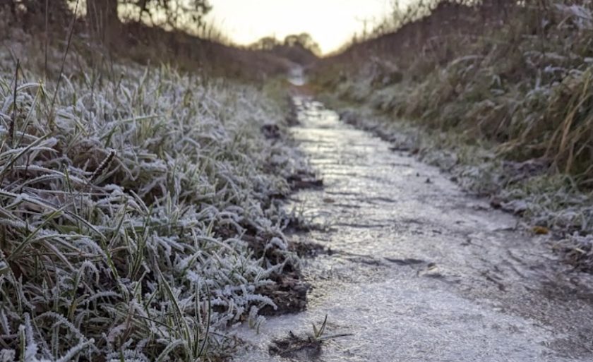
Overnight temperatures were milder locally than the previous few days with a low of -2.5ºC recorded at Hawarden airport at 2am, at 9am temperatures had risen to 2ºC.
The organisers of Wepre parkrun cancelled the weekly 5km event this morning as the paths and course have turned into “a sheet of ice.”
Wintry conditions are forecast to continue during the weekend, before milder and wetter weather sweeps, bringing at least a temporary reprieve.
A yellow alert for ice is in place in Flintshire until 12pm on Saturday.
The Met Office says: “Showery rain and sleet, with some snow, will lead to an ice risk this morning, and possible travel disruption.”
Expect some “icy patches on some untreated roads, pavements and cycle paths, leading to increased chance of accidents and injuries”
A yellow warning is in place from 3am on Sunday morning for ice with a “period of rain and snow mixed falling on frozen surfaces will lead to icy conditions causing some travel disruption.”
Met Office Chief Forecaster, Frank Saunders, said: “The UK will remain in a northerly airflow until the weekend but then the cold conditions, which have dominated our weather patterns will start to lose ground to a push of mild air from the southwest – but not without problems in the transition period.”
“As the mild air meets the cold air currently in situ over the UK there will be a transient spell of snow, even to low levels, especially in the north.”
“Add to this the risk of rain falling onto frozen surfaces, and strong winds over upland areas of northern Britain (bringing blizzard conditions briefly), and this could be a day to avoid travelling in some areas, although the snow should turn to rain later.”
Sunday will see the start of a marked change in weather type.”
“It will remain unsettled into next week, perhaps with a trend down in temperatures once again, although not as cold as we are currently experiencing.”
“We could potentially see a return of some wintery hazards but with a lot of uncertainty in how prolonged this might be and what associated hazards it might bring. Strong winds could prove disruptive at times in the first half of the week.”
Check live fuel prices near you before you set off.
Spotted something? Got a story? Email news (@) deeside.com
NEW: Add Deeside.com as a preferred source on Google to see more of our trusted coverage when you search.
Latest News