High pressure to dominate in UK over coming days, bringing prolonged warm spell for many
High pressure is set to dominate the UK over the coming days, bringing a prolonged warm spell for many.
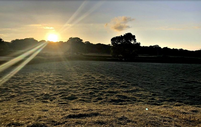
As the Azores High extends over the UK throughout this weekend, there will be little change to the weather which will allow temperatures to increase day on day.
This will also lead to prolonged sunshine for much of the UK, away from the far northwest where it’ll be cooler and cloudier.
The highest temperatures are expected in southern and central England and Wales, although temperatures across the vast majority of the UK will be above average through this week and into early next week.
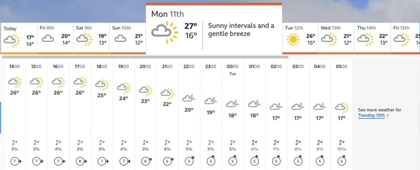
In Flintshire, Monday and Tuesday look like they are going to be the warmest two days with temperatures of 27C and 26C respectively followed by similar highs for next weekend.
Met Office Deputy Chief Meteorologist David Oliver said: “We’re at the start of a stretch of warm weather for much of England and Wales, that could last for much of next week.”
“In the short term, many can expect temperatures in the mid to high 20s Celsius over the weekend, and then in the low 30s Celsius during the start of next week. Much of next week will remain warm for the time of year as well as dry and sunny.”
High pressure means it’s warming up this weekend 🌡️
Friday is looking hot for some, then whilst temperatures may be a touch down on Saturday, they’re set to rise again for Sunday pic.twitter.com/4JrPCpUpqR
— Met Office (@metoffice) July 7, 2022
Further ahead
The warm spell will likely continue through much of next week and the following weekend, especially across southern areas.
Looking this far ahead always brings some uncertainty and so the exact temperatures are yet to be determined.
However, there is potential for temperatures to climb higher than over the coming days.
Speaking on the latest Met Office 10 Day Trend Met Office Meteorologist and Presenter Alex Deakin said: “There’s good model certainty that we’ll see a peak in temperatures in the early part of next week but there’s one possible scenario where temperatures get even higher late next week.”
“A more likely scenario is that temperatures return to something similar to Monday and Tuesday and there’s also a chance temperatures could drop much closer to average.”
Deputy Chief Meteorologist David Oliver added: “There are some runs, or solutions, that allow more extreme temperatures to develop into next weekend, which is something we will be monitoring closely over the coming days and adding more detail around into the new week.”
Check live fuel prices near you before you set off.
Spotted something? Got a story? Email news (@) deeside.com
NEW: Add Deeside.com as a preferred source on Google to see more of our trusted coverage when you search.
Latest News