Flintshire yellow wind warning updated as Storm Dave track becomes clearer ahead of Easter weekend
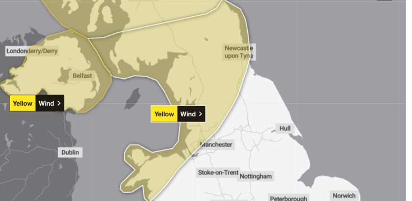
The Met Office has updated its yellow wind warning for Flintshire, extending the area covered and raising the likelihood of disruption as forecasters got a clearer picture of Storm Dave’s track.
The Met Office said the update reflected changes to both the geographic area affected and the chances of impacts occurring.
The warning runs from 5pm on Easter Saturday until 7am on Easter Sunday morning.
Met Office Deputy Chief Meteorologist Dan Holley said: “A significant cold plunge from Canada into the North Atlantic will impact our weekend weather, strengthening the jet stream and spinning up a deep area of low pressure towards the northwest of the UK on Saturday night.”
“This will lead to a spell of very strong winds later on Saturday, and overnight into the morning of Easter Sunday.”
“Winds should gradually ease through Easter Sunday as the area of low pressure clears to the North Sea,” he added.
Gusts of 50 to 60mph are expected across the warning area, with 60 to 70mph possible in exposed locations.
Flintshire is covered by the warning alongside Conwy, Denbighshire, Gwynedd and the Isle of Anglesey.
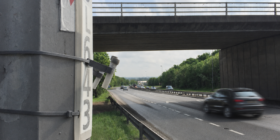
Delays to road, rail, air and ferry services are likely, with a chance of cancellations.
High-sided vehicles on exposed routes and bridges face an increased risk of delays.
Some road and bridge closures are also possible.
There is a slight chance of power cuts which could affect mobile phone coverage, and a slight chance of tiles being blown from roofs.
The Royal Society for the Prevention of Accidents is urging drivers across north Wales to take extra care over the holiday weekend.
Rebecca Guy, Senior Policy Manager at RoSPA, said: “With yellow wind warnings now in place across Scotland, Northern Ireland, Wales and parts of northern England this Easter weekend, and heavy rain expected to move in from Friday, anyone travelling should take extra care on the roads.”
“The combination of strong winds, which forecasters say could widely reach 50 to 60mph with even higher gusts in exposed areas, and periods of heavy rain will make driving conditions challenging.”
“Millions of people are expected to be on the move over the holiday period, so we’re urging drivers to plan ahead, allow extra time, and be prepared for delays.”
“In wet and windy conditions, it’s vital to slow down, increase the gap between you and the vehicle in front, and keep both hands firmly on the wheel.”
“Heavy rain can greatly reduce visibility and increase stopping distances,” Ms Guy said.
RoSPA recommends checking vehicles before setting off, including fuel or charge levels, oil, coolant, screenwash, tyre condition, lights, horn and wipers.
“If conditions worsen, don’t hesitate to delay or avoid your journey,” Ms Guy added.
“Your safety and the safety of other road users must always come first.”
The Met Office advises people to check for loose items outside their homes before the storm arrives, including bins, garden furniture, trampolines and fences.
Those on the coast are warned to stay away from the sea edge, as large waves can sweep people off their feet even from the shore.
People planning to travel on Saturday evening or early Easter Sunday morning are advised to check road conditions and transport timetables before setting out.
No further weather warnings are in place for the rest of the Easter week beyond Sunday morning.
Check live fuel prices near you before you set off.
Spotted something? Got a story? Email news (@) deeside.com
NEW: Add Deeside.com as a preferred source on Google to see more of our trusted coverage when you search.
Latest News