Flintshire included in latest Met Office snow warning
Flintshire is among the areas covered by a new yellow weather warning for snow and ice issued by the Met Office as the UK’s cold snap continues.
The warning is in force from 6 pm on Thursday until midday on Friday, highlighting the risk of heavy snow, strong winds and difficult travel conditions.
Forecasters say there is a possibility of delays on roads, with some vehicles and passengers potentially stranded. Rail and air travel could also be affected, while rural communities may become temporarily cut off.
Power cuts are possible, along with disruption to mobile phone services.
A deep area of low pressure, named Storm Goretti by Meteo France, is expected to move across the south of the UK from Thursday night into Friday. The storm will bring a mix of rain, snow and high winds, with the heaviest impacts forecast for northern France.
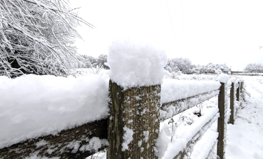
Across Wales, snow is likely to develop over higher ground before becoming more widespread overnight. Between 5 cm and 10 cm of snow could settle in some areas, with up to 20 cm possible on higher ground. Strong winds could cause drifting before conditions clear eastwards on Friday.
Met Office Chief Forecaster Jason Kelly said: “A further spell of snow is expected to move east across central and northern Scotland today. Elsewhere, snow showers will be mixed with rain and sleet and it will be another very cold day, with strengthening winds too. Overnight, cold air pushes back in with temperatures widely dipping below freezing again.”
Met Office Deputy Chief Forecaster Chris Bulmer added: “A deepening area of low pressure – named Storm Goretti by Meteo France – will move across the south of the UK during Thursday and into Friday. It will clash with the very cold air here, meaning Thursday night could be what we call a ‘multi-hazard’ event, with snow on the northern flank of the low, wind and rain on the southern flank.”
He said it was important that people “keep up-to-date with the latest forecasts” as warnings could be amended or escalated in the coming days.
Cold Arctic air remains in place across the UK, with overnight temperatures in recent days dropping as low as –12.5 °C in Norfolk. Further yellow warnings for ice are in force across much of England and Wales for overnight Tuesday into Wednesday.
The Met Office says temperatures will remain well below average into the weekend, with icy conditions and wintry showers continuing before milder air moves in from the west early next week.
Residents are advised to:
• plan journeys carefully and allow extra time;
• ensure vehicles are winter-ready;
• keep torches, batteries and power packs available in case of outages; and
• follow the latest local forecasts as conditions may change quickly.
– Flintshire is among the areas covered by a yellow weather warning for snow issued by the Met Office.
The warning is in force from 6pm on Thursday until midday on Friday and highlights the risk of heavy snow leading to disruption and difficult travel conditions.
Forecasters say there is a possibility of delays on roads, with some vehicles and passengers potentially stranded.
Rail and air travel could also be affected, while some rural communities may become temporarily cut off.
Power cuts are also possible, along with disruption to services such as mobile phone coverage.
The Met Office says a deep area of low pressure is expected to move across southern parts of the UK from Thursday into Friday, bringing a mix of rain, snow and strong winds. Snow is likely to develop over higher ground before becoming more widespread overnight.
In some areas, between 5cm and 10cm of snow could settle, with up to 20cm possible in places, particularly on higher ground. Strong winds could lead to drifting snow before conditions clear eastwards during Friday.
The weather system has been named Storm Goretti by Meteo France, although the strongest winds associated with the storm are expected to affect northern France rather than the UK.
The Met Office advises people to plan journeys carefully, check for road closures and delays, and allow extra time if travel is necessary.
Drivers are encouraged to ensure their vehicles are prepared for winter conditions and to carry essential items in case of delays.
Residents are also advised to prepare for possible power cuts by having torches, batteries and mobile phone power packs readily available, and to keep up to date with the latest forecasts as weather warnings can change quickly.
The warning is classed as yellow, meaning it carries a low likelihood but a medium potential impact.
Check live fuel prices near you before you set off.
Spotted something? Got a story? Email news (@) deeside.com
NEW: Add Deeside.com as a preferred source on Google to see more of our trusted coverage when you search.
Latest News